Geoplan’s desire to visualize a sub-meter level location data that its HW provides has become a new reality when we launched our own UWB RTLS platform, Geospace. Geospace is now a key Software that Geoplan utilizes to manage all UWB devices within the designated UWB area. With the development of Geospace, the company has a complete set of technologies to bring indoor location data to our customers.
Architecture of Geospace: Accuracy, Security, and Innovation
Geospace architecture leverages Microservices Architecture (MSA) to break down monolithic systems into smaller, independent services that enhance scalability, flexibility, and maintainability.
PostgreSQL serves as the robust database layer, handling large datasets with high availability and SQL standard compliance.
Communication is secured and optimized through HTTPS (ensuring encrypted data transmission) and HTTP/2.0 (improving performance with multiplexing and compression). Finally, Undertow, a lightweight Java-based web server, efficiently handles HTTP requests with blocking and non-blocking APIs, offering high performance and seamless integration with microservices. Together, these components ensure a modern, secure, and scalable software solution.
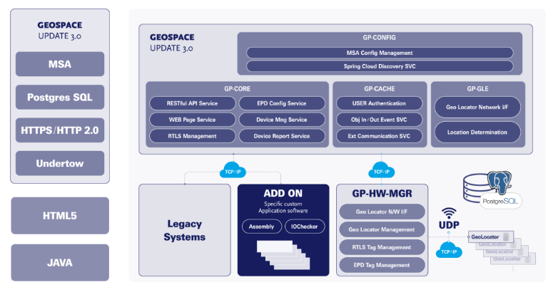
Source: Geoplan, Geospace architecture
How Does Geospace Works with UWB Locators and Tags
Geoplan’s Geospace communicates with UWB hardware through TDoA (time difference of arrival) which enables two-way-communication, allowing Geospace not only receive the data from UWB devices but also control of these devices through the application.
The process is quite simple: UWB tags send the raw real-time location data to UWB locators which are there to collect the location information and transmit it to Geospace. As a middleware application, Geospace processes the data it received from UWB locators and sends the processed X/Y location data to the end-user location based applications.
Stay tuned for Geoplan’s soon-to-be released end-user RTLS software.
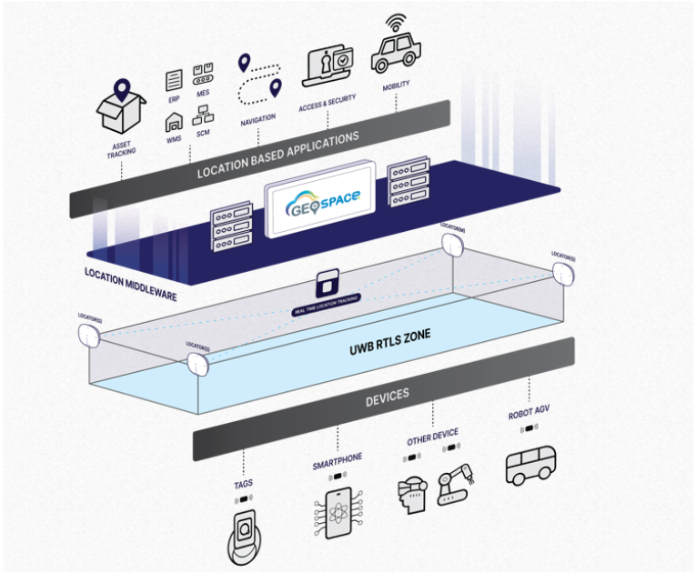
Source: Geoplan, UWB RTLS diagram